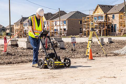
Sensors & Software Inc. from Radiodetection announces GPR-SG, a new GNSS positioning system for LMX, Noggin and pulseEKKO ground penetrating radar (GPR) systems, with GPR now entering Radiodetection’s suite of Map It Your Way solutions.
Accurate positioning is critical for GPR surveys, and it can be used to accurately map buried assets, determine the location of detected subsurface objects, identify areas to avoid digging and record locations.
Sensors & Software now offers GPR products with a plug-and-play, out-of-the-box GNSS accessory with an accuracy ranging from 30cm RMS* (using free, local SBAS corrections), 20 cm RMS* (using Galileo High Accuracy Service), down to 1cm RMS* (using an RTK correction service - not included), allowing you to select the desired level of accuracy that works best for your business.
Flexibility is at the heart of our mapping solutions, allowing customers to choose the most suitable solution for their needs. We offer turnkey options for those new to the world of utility mapping, while mapping experts can continue using their own, 3rd party GNSS solutions and software, ensuring the flexibility needed to meet advanced data collection & mapping needs.
Sensors & Software’s GPR-SG products are designed for customers desiring a GNSS solution that works out of the box - just plug-and-play – with connectivity, setup and battery management all taken care of at the system level, making it easy to incorporate precise positioning into your GPR workflow.
The GPR-SG accessories are available for new or existing Sensors & Software GPR systems, including SPIDAR. For LMX customers, look for new LMX200-SG and LMX150-SG systems with a pre-bundled GNSS solution.
Adding a GNSS solution with your GPR system enables powerful, in-field features and post-processing analysis.
- Use the SplitView feature on LMXs to simultaneously follow utilities in map view and cross-section view, allowing you to easily plot the path of utilities and output coordinates.
- Accurate positioning of GPR data is especially important when collecting “pseudo-grid” data, that is, data collected over an area by zigzagging across the area of interest, like you are mowing the lawn.
- The GPR data is then processed into a series of depth slices below the surface. Depth slice map images make GPR interpretation easier by quickly showing the spatial relationships between objects, and revealing linear objects, such as utilities.
The accurate GNSS positioning is incorporated into the GPR data and interpretations, and the output is in standard file formats, allowing you to quickly and seamlessly integrate GPR results into your preferred mapping solution.
This new offering adds to the suite of mapping technologies available from Radiodetection, allowing you to easily map underground assets. For additional information on GPR-SG, visit the Sensors & Software website at www.sensoft.ca.