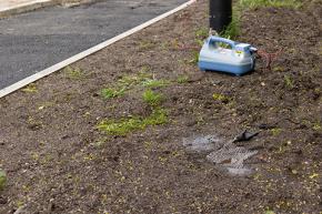
The Earth Mat - Designed to provide enhanced safety for locating and digging operatives
24 April 2024
Radiodetection's new accessory, the Earth Mat, has arrived. The Earth Mat is the new easy way for your Tx10/Tx10B, Tx5 Transmitter or Genny4 to connect to ground. Simply lay the Earth Mat out flat on the ground and connect the black Transmitter or Genny Direct Connect Lead. Pour a little water on the Earth Mat for an improved signal and start scanning immediately.

